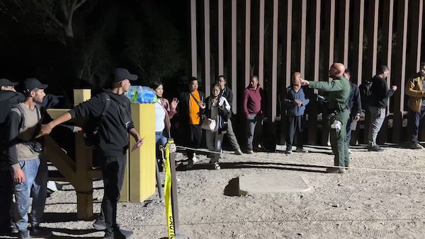
While the rest of us were focused on deep-sea submarines and DC soap opera drama, foreign powers have continued to exploit the mostly-undefended Southern border.
Many on the right still recognize this as an urgent story. And State governments are looking for creative ways to stem the unhindered wave of humanity washing ashore across that undefended border.
We see some combination of legal tactics (court cases); changes to laws; increased manpower for enforcement; and even creative use of physical barriers to keep them from entering in the first place. (Abbott is now testing the installation of floating barriers mid-river to slow the advance of border-crossing even before they set foot on shore).
But the REAL immigration problem isn’t on the Mexican side of the border. It’s where people from all over the planet begin this journey in the first place.
(And guess who’s paying for it!)
Unlike so many people who sit at a desk in DC or New York and tell us there is nothing to worry about, Michael Yon has actually been to the border — and more than that — he has traveled the entire length of the corridor these ‘migrants’ from all over the world have been using.
He has photos (his own photos) of a well-established camp right next to a hospital that was marked on the map. His photos show the progress of buildings in a camp that was already well-established in 2022 and is much more sophisticated today.
When I punch in the exact coordinates that are on the map (searched today), Google Maps gives me this image:

For some reason, Google shows no sign of new developments that have sprung up beside the hospital indicated on the map.
This location gives us a view of Panama, Darien province.

If that sounds familiar, you have probably heard of the Darien Gap. We’ve mentioned it in some of our stories. It’s a dangerous leg of the journey to America where hundreds die, and far more than that are robbed or raped.
Michael Yon calls the location in this photo an ‘invasion camp,’ and (if you look through his Twitter timeline) you will find he has made a very strong case for why he would want to call it that.
Here is what Google Maps does NOT include in that image:
Google Earth Not Showing US Sponsored invasion camps in Darien Province, Panama. (All these images are mine other than the Google Earth image.) The Google Earth image contains coordinates so you can check. This camp, San Vicente, is the camp Chinese infiltrators of USA use the… pic.twitter.com/9QsrdkD9LO
— Michael Yon Jungle (@Michael_Yon) June 22, 2023
Apple Maps has some very conveniently placed cloud covers.

About 2 weeks ago there was a video posted here on Twitter of US busses picking up #illegals from the #DarianGap to be transported to the United States.
— MaryMacElveen (@MaryMacElveen) June 22, 2023
From Border Patrol agent — I reworded without changing meaning:
[I interviewed aliens yesterday. From Tajikistan. The Tajiks flew into Nicaragua and were met by a professional setup that separated them by nationality. Photographed and loaded them on buses. Tajiks said they… pic.twitter.com/Yn2uSUA716
— Michael Yon Jungle (@Michael_Yon) June 21, 2023
FACT: US Government continues building infrastructure Chinese are using to invade United States. FACT: USG knows Chinese spies use this infrastructure to invade USA. FACT: is expanding the invasion of Chinese and others into United States.
Below is San Vicente Camp in… pic.twitter.com/hwBvbEm1iR
— Michael Yon Jungle (@Michael_Yon) June 19, 2023
CCP invasion route to United States….PLEASE FOLLOW, AND SHARE WIDELY. We are being invaded. pic.twitter.com/sNvoMfzD5y
— Michael Yon Jungle (@Michael_Yon) June 18, 2023
Dear @RepMarkGreen,
We have lists of Chinese military-age men, their names, their passport numbers, their date of entry into the U.S. government-orchestrated illegal alien invasion of the U.S. and evidence of the connections of some to the CCP/PLA.
Do you?
Does U.S. intelligence? https://t.co/OJZaUVZFWR— Dr. Lawrence Sellin (@LawrenceSellin) June 16, 2023
Are you paying attention yet
Cross-:Posted with Clash Daily


